Jagged rocky cliffs rising from the sea at sunset with waves crashing against the rocks.
Scroll Scroll

Your guide to visiting Malin Head Donegal

Malin Head Donegal is Ireland’s most northerly point and one of the most striking stops on the Wild Atlantic Way. 

Known for its exposed cliffs, open coastline and historic landmarks, it offers a clear sense of place at the edge of the Atlantic. 

In this guide, we look at how to get there, what to see, walking routes, safety tips, nearby attractions and how Malin Head fits into a wider northwest itinerary, with Riverside Hotel Sligo as a comfortable base.

Why Malin Head belongs on your Wild Atlantic Way itinerary

Malin Head is defined by its landscape. Steep cliffs drop into the Atlantic, the coastline is rugged and largely undeveloped, and weather systems move through quickly, changing the light and sea conditions throughout the day. 

Located at the tip of the Inishowen Peninsula, it marks a natural turning point on a Wild Atlantic Way road trip.

Malin Head Donegal works particularly well alongside time spent in Sligo and the rest of Donegal. Together, they offer a mix of coastal scenery, beaches, walking routes and towns, without long backtracking between destinations.

Getting to Malin Head from Sligo and beyond

From Sligo, Malin Head is approximately 184 kilometres away, with a driving time of around two and a half to three hours, depending on traffic and stops. 

The route passes through rural parts of Donegal, where progress can be slower but the scenery makes the journey worthwhile.

Public transport options are limited near Malin Head itself. Some visitors combine bus routes with a taxi for the final stretch, but most choose to drive. 

Roads close to Malin Head Viewpoint are narrow and winding, so allowing extra time and travelling in daylight is always advisable.

Staying at Riverside Hotel Sligo suits travellers exploring several Wild Atlantic Way counties. You can enjoy Sligo’s attractions on other days and plan Malin Head Donegal as a dedicated day trip or overnight loop.

Malin Head highlights: Banba’s Crown, the Tower and the Eire 80 sign

Most visits focus on Banba’s Crown, the northernmost point. 

Here you will see the signal tower, built in the early 1800s as part of a coastal defence system, and the Eire 80 sign, created during the Second World War to identify Ireland to aircraft.

From the Malin Head Viewpoint, there are clear views out to Inishtrahull Island, and on good days, the outline of Scotland can be visible. Parking is available nearby, with short, clearly marked paths linking the main features.

Walking the Malin Head coastal trail and staying safe

The main coastal walk runs from Banba’s Crown towards Hell’s Hole and Devil’s Bridge.

It is not long, but it follows exposed cliff-top paths and is highly dependent on weather conditions. Along the way, you will see sea arches, steep rock faces and views back across Ballyhillion Beach.

Visitors should stay well back from cliff edges, supervise children closely and follow all signage. 

Strong winds and wet ground can make conditions hazardous, so avoiding walks during storms or very windy days is important. The landscape is impressive, but it requires care and attention.

Wildlife, northern lights and Star Wars connections

Malin Head is a recognised spot for wildlife watching. Seabirds are common along the cliffs, and dolphins or basking sharks are sometimes seen offshore during the summer months. 

On occasional clear nights, the Northern Lights may be visible, though sightings are never guaranteed.

The area also featured in Star Wars: The Last Jedi, with filming taking place around Malin Head Donegal. 

A Millennium Falcon replica was installed locally, and nearby Malin Town, including Farren’s Bar, became a stop for cast and crew. Visitors hoping to see the aurora should check local forecasts and weather apps in advance.

Things to do near Malin Head on the Inishowen Peninsula

The Inishowen Peninsula has several nearby attractions that fit easily around a Malin Head visit. Five Finger Strand offers a long sandy beach, while the Knockamany Bends provide elevated views over Lough Swilly. 

Glenevin Waterfall is an accessible walk, and Doagh Famine Village offers insight into local history.

Travellers starting in Sligo often combine Malin Head with other Donegal locations over two or three days, following parts of the Inishowen 100 route before returning south.

Practical tips for your Malin Head visit

Access to Malin Head is free. Parking is available at both upper and lower car parks near the main viewpoints. Toilet facilities are limited, and there are few permanent services beyond seasonal coffee vans and small local businesses.

Dogs are allowed but should be kept under control near cliffs and farmland. Wear layers, waterproof clothing and sturdy footwear, and bring water and snacks. Check opening times for any paid attractions nearby before you travel.

Combining Malin Head with a stay in Sligo

Malin Head Donegal fits well into a northwest Ireland itinerary based in Sligo. 

From Riverside Hotel Sligo, visitors can explore Sligo’s beaches, walking routes and cultural sites on some days, while setting aside time for Donegal highlights like Malin Head.

The hotel’s riverside, town-centre location makes it easy to relax after a long day of driving, with dining options on site and views over the Garavogue River. It offers a practical and comfortable base for wider exploration.

Ready to explore the northwest? Book your Riverside Hotel Sligo stay

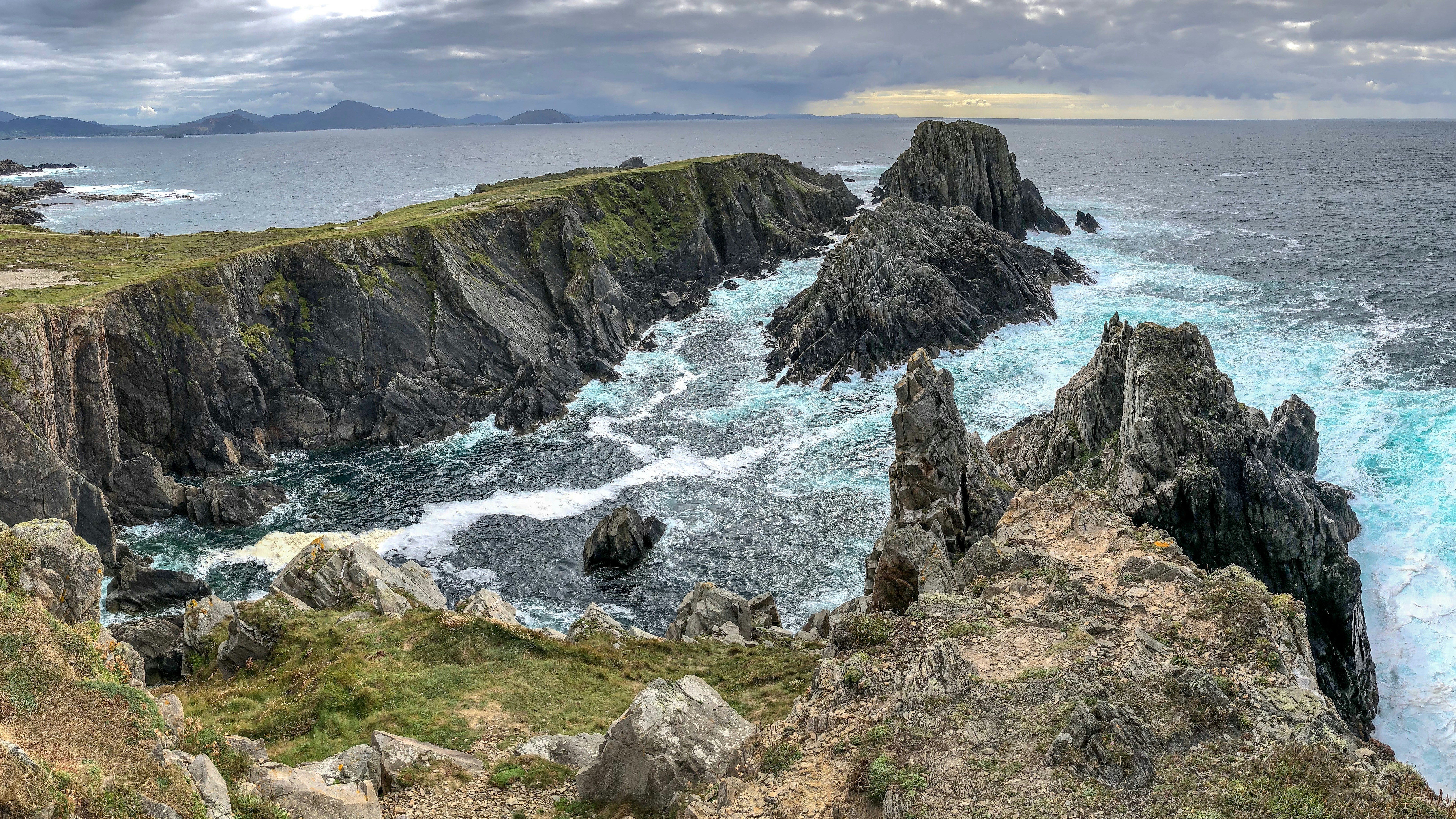
If Malin Head Donegal is part of your Wild Atlantic Way plans, Riverside Hotel Sligo provides a convenient place to stay. 

Check current offers, choose your dates and book a base that allows you to explore Sligo, Donegal and the surrounding coastline at a steady pace. 

The team are happy to share local route advice and day-trip ideas to help you plan your stay.